1887

Advances in Gravity and Magnetic Processing and Interpretation
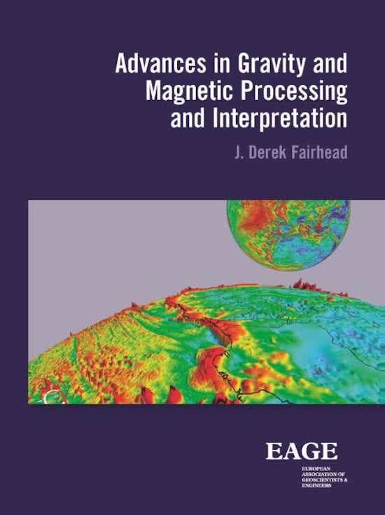
image of Advances in Gravity and Magnetic Processing and Interpretation
  • By J. Derek Fairhead
  • Format: EPUB
  • Publication Year: 2015
  • Number of Pages: 325
  • Language: English
  • Ebook ISBN: 9789462821774

This book results from over 40 years of teaching the subject at post graduate (Masters) level to geophysical exploration geoscientists. It provides an insight into the acquisition, advanced processing and interpretation of gravity and magnetic data used in today’s oil and mineral exploration industries. The book does not go into any detailed mathematical treatment of potential field theory which is more than adequately covered by other recently published text books, but adopts a more practical approach of how one processes and interprets gravity and magnetic profile and grid data to generate 3D structural depth maps.
Advanced processing and interpretation have evolved significantly over the last two decades. The traditional amplitude derivative methods are now augmented by powerful local phase and local wavenumber derivative methods, all of which are used to identify and map structural lineaments as well as providing accurate depth estimations using infinite and finite depth models.
In what one can call the post-Euler era, interpretation methods have evolved from generating clouds of Euler depth solutions to estimating depths of individual magnetic anomalies. Where sedimentary basins are at their deepest, there is often a sparsity of depth solutions but not magnetic data. Transforming the magnetic data into pseudo-gravity now provides a means of mapping the whole basement surface. The book draws extensively on collaborative works with Dr Ahmed Salem, other colleagues and research students via publications which are references both within the text and at the end of each section.

Table of Contents

About the Author
Preface
Acknowledgements
1 Introduction

1.1. The role of gravity and magnetic methods in oil and mineral exploration
1.1.1 The role of gravity and magnetic methods in oil exploration
1.1.2 Role of gravity and magnetic methods in mineral exploration
1.1.3 Reference books
1.1.4 Historic perspective
1.2. Physical properties and differences of gravity and magnetic fields
1.2.1 General properties of gravity
1.2.2 The cause and effects of the Earth’s gravity field
1.2.3 Gravity units
1.2.4 General properties of magnetics
1.2.5 The cause and effects of the Earth’s magnetic field
1.2.6 Magnetic units
1.2.7 Common magnetic minerals
1.2.8 References
1.3. Controls on the shape and size of gravity and magnetic anomalies
1.3.1 Gravity and magnetic responses from isolated sources
1.3.2 Controls on size and shape of gravity and magnetic anomalies
1.3.3 Understanding the shape of gravity and magnetic anomalies
1.3.4 Magnetostatic field charge of 3D blocks and reason for magnetic anisotropy at the magnetic equator
1.3.5 Variation of density and seismic velocity with depth
1.3.6 References
1.4. Electromagnetic Methods (EM and CSEM) and induced polarization (IP)
1.4.1 Towed streamer EM method
1.4.2 Controlled source electromagnetic method, CSEM
1.4.3 Towed induced polarization method, IP
1.4.4 References
2 Gravity anomaly types, acquisition, processing, and QC
2.1. Gravity anomaly types
2.1.1 Geoid, U
2.1.2 Free air anomaly, FAA
2.1.3 Bouguer anomaly, BA
2.1.4 Isostatic residual anomaly, IsoA
2.1.5 Decompensative anomaly
2.1.6 References
2.2. Advances in gravity acquisition resolution and land gravity data (static)
2.2.1 Advances in gravity acquisition resolution
2.2.2 Land gravity meters
2.2.3 Land survey procedure
2.2.4 Micro gravity surveys
2.2.5 Land survey design
2.2.6 Quality control (QC) of land gravity surveys
2.2.7 References
2.3. Marine gravity data (dynamic and static)
2.3.1 Observed marine gravity, gobs
2.3.2 Marine gravity meters (dynamic)
2.3.3 Processing of marine dynamic gravity data
2.3.4 Sea-bed gravity measurements (static)
2.3.5 Reference
2.4. Airborne gravity data (dynamic)
2.4.1 Airborne gravity
2.4.2 Current status of airborne gravity
2.4.3 Airborne gravity quality control (QC)
2.4.4 References
2.5. Satellite derived gravity data (dynamic and static)
2.5.1 Dynamic measurements
2.5.2 Satellite altimeter Method (static)
2.5.3 2002-2004 Getech solution
2.5.4 2008-2009 Getech solution
2.5.5 2013-2016 Getech solution
2.5.6 Public domain solutions (2014)
2.5.7 Relation between sea surface and gravity spectra
2.5.8 References
2.6. Gravity gradiometry (static)
2.6.1 Old technology: Eötvös torsion balance
2.6.2 New technology: Tensor gradiometer
2.6.3 Modern Tensor instruments
2.6.4 Resolution comparison between gravity, Gz, and gradiometer data, Gzz, with depth
2.6.5 References
2.7. Global gravity models
2.7.1 EGM08 geopotential public domain model
2.7.2 Getech commercial global gravity model
2.7.3 Global gravity analysis
2.7.4 References
3 Magnetic anomaly types, acquisition, processing, and QC
3.1. Magnetic anomaly types
3.1.1 Total magnetic intensity, TMI
3.1.2 Reduction-to-pole anomaly, RTP, and equator, RTE
3.1.3 References
3.2. Land and marine magnetometers, acquisition, and survey quality control
3.2.1 Relative measuring magnetometers (old)
3.2.2 Absolute magnetometers
3.2.3 Absolute gradiometers
3.2.4 Magnetic data processing (ground)
3.2.5 Ground magnetic data quality control (QC)
3.2.6 Marine magnetic systems
3.2.7 References
3.3. Airborne magnetometers, acquisition, and survey quality control
3.3.1 Airborne acquisition
3.3.2 Survey design
3.3.3 Survey quality control (QC)
3.3.4 References
3.4. Global magnetic fields and models
3.4.1 Dipole magnetic field of the Earth
3.4.2 Satellite crustal magnetic field of the Earth
3.4.3 Terrestrial global magnetic field models
3.4.4 References
4 Mapping
4.1. Geodetic datums and map projections
4.1.1 Geodetic map datum
4.1.2 Map projections
4.1.3 Map coordinates
4.1.4 Geophysical data datums
4.1.5 Reference
4.2. Gridding and mapping point and profile data (and linking surveys)
4.2.1 Hand contouring
4.2.2 Computer gridding of point data
4.2.3 Computer gridding of profile data
4.2.4 Extensions to gridding methods
4.2.5 Linking aeromagnetic surveys
4.2.6 References
4.3. Cleaning up gravity and magnetic survey data
4.3.1 Deculturing aeromagnetic data
4.3.2 Line levelling profile data
4.3.3 References
4.4. Colour imaging
4.4.1 Colour and shaded relief mapping
4.4.2 Reference
5 Data enhancement
5.1. Transforms and geological filters
5.1.1 Transforms
5.1.2 Mathematical filters
5.1.3 Geological filters
5.1.4 References
5.2. Amplitude derivatives
5.2.1 The 3D Bishop models
5.2.2 Separating the anomaly
5.2.3 Amplitude (or magnitude) derivatives
A. Total horizontal derivative, THDR
B. First vertical derivative, VDR
C. Second vertical derivative, SVDR
D. Dip-azimuth derivative
E. Analytic signal, AS
5.2.4 References
5.3. Phase derivatives
5.3.1 Local phase, Ɵ
5.3.2 Tilt derivative, Tilt
5.3.3 Theta derivative, cos[Tilt]
5.3.4 TDX derivative
5.3.5 Comparison between Tilt, Theta and TDX
5.3.6 Local wavenumber, K
5.3.7 References
6 Quantitative Interpretation
6.1. Structural mapping-edge detection of faults and contacts
6.1.1 Derivatives and structural edges
6.1.2 Computer lineament detection
6.1.3 Geological controls on lineament (ridge) location
6.1.4 Worming
6.1.5 Automated lineament tracking
6.1.6 Tracking density (or susceptibility) contrasts across edges/lineaments
6.1.7 Special case: Tracking structures (edges) close to the magnetic equator
6.1.8 Examples of structural mapping
6.1.9 Interpretation tips
6.1.10 References
7 Profile depth (2D) estimation
7.1. Manual gravity and magnetic methods
7.1.1 Depth determination using standard curves
7.1.2 Centre of body using standard curves
7.1.3 Depth estimation using simple geological structures
7.1.4 References
7.2. 2D profile forward and inversion modelling
7.2.1 2D magnetic forward modelling
7.2.2 2D gravity forward modelling
7.2.3 Examples of 2D modelling
7.2.4 Profile inversion of gravity data using isostatic constraints
7.2.5 References
7.3. Semi-automatic profile methods
7.3.1 Naudy method
7.3.2 Werner method
7.3.3 Conventional 2D Euler method
7.3.4 Extended 2D Euler method
7.3.5 Local wavenumber: source parameter imaging (SPI) method
7.3.6 The AN-EUL method
7.3.7 Tilted basement block method
7.3.8 References
8 Grid depth 3D estimation
8.1. Euler deconvolution 3D methods
8.1.1 Conventional grid 3D Euler
8.1.2 Laplacian XY Euler
8.1.3 2D constrained grid 3D Euler
8.1.4 Tensor Euler
8.1.5 Hilbert Euler
8.1.6 General comments
8.1.7 References
8.2. Tilt-depth (local phase and wavenumber) grid methods
8.2.1 Conventional (infinite) tilt-depth method
8.2.2 Extended (infinite) tilt-depth method (using local wavenumber, K)
8.2.3 Adapted conventional (infinite) tilt-depth (tensor gravity) method
8.2.4 Conventional (infinite) tilt-depth and RTE interpretation
8.2.5 Comparing the infinite and finite tilt-depth models
8.2.6 Redefining the conventional tilt-depth method using finite depth model
8.2.7 Redefining the extended tilt-depth method using finite depth contact model and local wavenumber, K
8.2.8 Recent tilt-depth developments
8.2.9 References
8.3. Power spectrum depth estimation methods
8.3.1 Basics of Fourier transforms for filtering and power spectrum
8.3.2 Power spectrum analysis of magnetic data to measure depth to top
8.3.3 Mapping the depth of the Curie point isotherm ‘magnetic bottom’ using aeromagnetic data
8.3.4 References
9 3D modelling methods
9.1. 3D forward modelling in the space domain (gravity)
9.1.1 Cordell and Henderson method
9.1.2 Enhanced Cordell and Henderson method (using density–depth function)
9.1.3 Muglad basin, Western Sudan: example of automated 3D forward modelling integrated interpretation method to determine basin structure
9.1.4 References
9.2. 3D forward modelling in the wavenumber domain (gravity and magnetic)
9.2.1 Parker’s Method
9.2.2 References
9.3. Magnetic inversion using pseudo-gravity (wavenumber domain)
9.3.1 Vertical integral or pseudo-gravity method of inversion
9.3.2 Application 1: Stord basin, North Sea
9.3.3 Application 2: Abu Gharadig basin, Western Desert, Egypt
9.3.4 References
Index

References

http://instance.metastore.ingenta.com/content/books/9789462821774
Loading
/content/books/9789462821774
dcterms_title,dcterms_subject,pub_author,pub_keyword
-contentType:Journal
10
5
This is a required field
Please enter a valid email address
Approval was a Success
Invalid data
An Error Occurred
Approval was partially successful, following selected items could not be processed due to error