1887

Application Manual of Geophysical Methods to Engineering and Environmental Problems
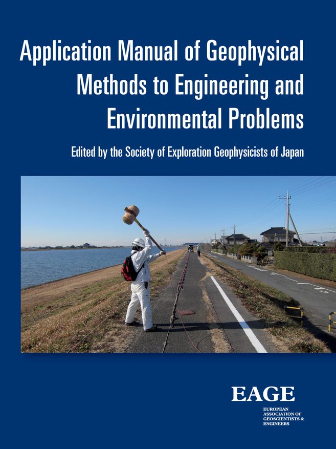
image of Application Manual of Geophysical Methods to Engineering and Environmental Problems
  • By T. Aizawa
  • Format: EPUB
  • Publication Year: 2014
  • Number of Pages: 664
  • Language: English
  • Ebook ISBN: 9789462821088

This book is a comprehensive manual of shallow geophysical surveys for engineering and environmental applications.
It describes details of applicability and limitation, field procedure, analysis and interpretation of geophysical methods in simple terms. Keep this manual on your desktop and refer to it from time to time to improve the quality of your work in construction engineering and environmental maintenance.

This manual of geophysical surveys describes the standard procedure of practice rather than the basic theories of geophysical methods. Its intention is to share our experience with young geophysicists who collect and analyze geophysical data and clients who use results of geophysical surveys. It describes standard operational procedure of data acquisition and analysis in each method to reach a sound interpretation of the data. It also includes a due consideration on performance efficiency, quality control and reporting. Geophysicists may refer to this manual in all the stages of a survey: data acquisition, processing, analysis and interpretation. To the clients of the survey, this manual may be particularly useful in understanding the surveys from planning to assessing the outcome: how data are presented.

Table of Contents

Preface
Foreword
Contents
1 Introduction

1. Introduction
2. Survey Principles
3. Workflow of Surveys
4. Selection of a Geophysical Method
5. Planning and Preparation
6. Setting Up Survey Lines and Location Survey
7. Field Operation
8. Data Processing
9. Data Analysis
10. Interpretation
11. Deliverable and Electronic Data

2 The Seismic Refraction Method
1. General
2. Applicability
3. Planning
3.1 Desk Study and Basic Plan
3.2 Planning Survey Lines
3.3 Planning of Receiver and Shot Points
3.4 Seismic Sources
4. Field Data Acquisition
4.1 Instrumentation
4.2 Access Permits
4.3 Preparation and Handling of Explosives
4.4 Setting and Location Survey of Seismic Lines
4.5 Field Operation and Recording
4.6 Safety
5. Data Processing
5.1 Workflow of Data Processing
5.2 Measurement of First Arrival Traveltimes
5.3 Preparation of Traveltime Graphs
5.4 Examination and Adjustment of Traveltime Data
6. Analysis by Hagiwara’s Method
6.1 Recognition of Velocity Layers on Traveltime Curves
6.2 Preparation of Cross-sections
6.3 Limitations of the Seismic Refraction Method
7. Analysis by Tomographic Inversion
7.1 Analysis Method
7.2 Analysis of Borehole Source and Receivers
8. Interpretation of Results
8.1 Interpretation of Results
8.2 Applications in Civil Engineering Investigations
8.3 Difficult Geology and Suggested Actions
9. Deliverables
References

3 Shallow Seismic Reflection Method
1. General
2. Applicability
3. Planning
3.1 Desk Study
3.2 Data Acquisition Parameters and Instruments
3.3 Setting Survey Lines
3.4 Spread Length and Depth of Probe
3.5 Spread Style
3.6 Geophone Interval and Shot Interval
3.7 Choice of Wave Type
3.8 Instrumentation
4. Field Operation
4.1 Access Permit
4.2 Location Survey
4.3 Preparation on Site
4.4 Data Recording
5. Data Processing
5.1 Data Organization
5.2 Data Processing and Analysis
6. Interpretation
6.1 Interpretation
6.2 Resolution of Analysis
7. Deliverables and Reporting
References

4 The Surface Wave Method
1. General
1.1 Outline of the Method
2. Principle
3. Applicability
4. Planning
4.1 Selection of Method
4.2 General Survey Plan
4.3 Arrangement of Source and Receivers
5. Survey Method
5.1 Instrumentation
5.2 Receivers (Geophones)
5.3 Source
5.4 Field Procedure
5.5 Quality Control of Data
6. Analysis
7. Deliverables
7.1 Deliverables
7.2 Report
References

5 The Microtremor Method
1. General
1.1 General
2. Applicability
3. Plan and Design
3.1 Selection the Technique
3.2 Array Design
3.3 Planning Observation Points
3.4 Planning the Survey Time
4. Array Observation of a Microtremor
4.1 Observation Equipment
4.2 Location Scouting
4.3 Huddle Test
4.4 Array Observation
5. Data Analysis
5.1 Phase Velocity Analysis
5.2 Velocity Structural Analysis
6. Deliverable and Report
References and Further Reading

6 The Geoelectrical Method
1. General
2. Principle
2.1 Resistivity Method
2.2 The Spontaneous Potential Method
3. Application
4. Terminology
References

6.1 The Vertical Sounding Resistivity Method
1. General
2. Applicability
3. Planning
3.1 Advance Review
3.2 Planning of Data Acquisition
3.2.1 Survey Plan
3.2.2 Planning of Measurement Points Layout and Deployment Direction
3.2.3 Choice of Electrode Configuration and Measurement Method
3.2.4 Deciding the Sounding Depth and Electrode Spacing
4. Instrumentation
5. Field Operations
5.1 Planning and Safety Issues
5.2 Field Procedure
5.3 Setting of Measurement Position and Electrodes
5.4 Connection of Cables
5.5 Measurement
5.5.1 Preparation
5.5.2 Measurement
6. Data Processing
6.1 Location Map of Measurement Points
6.2 Apparent Resistivity Curves
7. Analysis
7.1 Analysis Method
7.2 Standard Curve Method
7.3 Curve-matching Method
8. Interpretation
9. Deliverables and Reports
9.1 Deliverables and Reports
9.2 Disposition of Survey Data

6.2 2D 3D Resistivity Surveys
1. General
2. Applicability
3. Planning
3.1 Choice of Measurement Method
3.2 Planning of Data Acquisition
3.2.1 Survey Planning
3.2.2 Planning Survey Line Setup
3.2.3 Setting of Survey Line Length for Sounding Depth
3.2.4 Setting of Electrodes (Measurement Points)
3.2.5 Selection of Electrode Configuration
3.2.6 Planning of Remote Electrodes
4. Instrumentation
5. Field Operations
5.1 Process Adjustment and Safety Issues
5.2 Field Procedure
5.3 Setting the Measurement Positions and Electrodes
5.3.1 Location Survey
5.3.2 Setting the Electrodes
5.3.3 Connection of Cables
5.4 Measurement
5.4.1 Preparation
5.4.2 Measurement Method
5.4.3 Measurement
6. Data Processing
6.1 Measurement Location
6.2 Editing Measurement Results
6.3 Primary Processing of Measured Data
7. Analysis
7.1 Analysis Method
7.2 Analysis Procedure
7.3 Organizing Analysis Data File
7.3.1 Processing Measurement Data
7.3.2 Organizing the Analysis Data File
7.4 Execution of Analysis
7.4.1 Analysis Parameters
7.4.2 Execution of the Analysis
7.4.3 Checking Analysis Results
7.4.4 Displaying the Analysis Results
7.5 Interpretation of Sounding Results
8. Deliverables and Reports
8.1 Deliverables and Reports
8.2 Storage of Survey Data
References

6.3 The Self-Potential Method
1. General
2. Applicability
3. Planning
4. Field Survey
4.1 Permission to Carry Out the Survey
4.2 Instrumentation
4.3 Field Procedure
5. Data Processing and Analysis
5.1 Data Processing
5.2 Analysis and Interpretation
6. Deliverables
6.1 Deliverables
6.2 Report
References

7 Electromagnetic Method
1. General
2. Principle
3. Application
4. Terminology
References

7.1 MT and AMT Methods
1. General
2. Applicability
3. Planning
3.1 Selection of Method
3.2 Planning of Data Acquisition
4. Field Operation
4.1 Preliminary Site Investigation
4.2 Preparation for Measurement
4.3 Field Measurement
5. Data Processing and Interpretation
5.1 Data Processing
5.2 Analysis
6. Deliverables
6.1 Deliverable
6.2 Report
References and Further Reading

7.2 CSAMT Method
1. General
2. Applicability
3. Planning
3.1 Selection of Method
3.2 Planning Data Acquisition
3.2.1 Planning Survey Stations
3.2.2 Planning of Transmission Source
3.2.3 Planning Frequency for Measurement
3.2.4 Depth of Probe
4. Field Works
4.1 Site Scouting
4.2 Preparation for Measurement
4.2.1 Equipment for Source
4.2.2 Equipment for Measurement
4.2.3 Installation of Signal Source Transmitter
4.3 Field Measurement
4.3.1 Transmitting Signals
4.3.2 Measurement
5. Preprocessing and Interpretation
5.1 Preprocessing
5.2 Interpretation
6. Report
6.1 Deliverable
6.2 Reports

7.3 TEM Method
1. General
2. Applicability
3. Planning
3.1 Selection of Method
3.2 Planning of Data Acquisition
4. Field Works
4.1 Site Scouting
4.2 Preparation for Measurements
4.2.1 Measurement Equipment
4.3 Field Measurement
4.3.1 Site Measurement
5. Data Preprocessing and Interpretation
5.1 Data Preprocessing
5.2 Interpretation
5.3 Interpretation
6. Reporting
6.1 Deliverable
6.2 Reports
References

7.4 Airborne EM Method
1. General
2. Application Area
3. Planning
3.1 Selection of Method
3.2 Planning Flight Lines
3.3 Application for Permission to the Civil Aviation Authority
3.4 Depth of Probe
4. Measurement
4.1 Equipment for Measurements
4.2 Preparation for Measurements
4.3 Adjustment/Calibration of the Instrument for Electromagnetic Measurement
4.4 Measurement
4.5 Quality Control of the Measurement Data
4.6 Safety Measures
5. Data Processing
5.1 Data Base for Interpretation
5.2 Drawing of Flight Paths
5.3 Primary Processing
5.4 Secondary Processing
5.5 Interpretation of Results
5.6 Display of the Results
6. Analysis Incorporating Other Information
6.1 Geological Interpretation of Analysis Results
7. Report and Deliverables
7.1 Overview
7.2 Report and Deliverables

7.5 Loop-Loop Method (Slingram Method)
1. General
2. Applicability
3. Planning
3.1 Selection of Method
3.2 Planning of Data Acquisition
4. Field Operation
4.1 Site Scouting
4.2 Preparation for Survey
4.3 On-Site Measurements
5. Data Processing and Interpretation
5.1 Processing and Interpretation
6. Deliverables
6.1 Deliverables
6.2 Reports
References

7.6 VLF Methods
1. General
2. Applicability
3. Planning
3.1 Selection of Method
3.2 Planning of Data Acquisition
4. Field Data Acquisition
4.1 Preparation
4.2 Field Data Acquisition
5. Data Processing and Analysis
5.1 Data Processing and Analysis
6. Report
6.1 Deliverable
6.2 Reports
References

8 Ground Penetrating Radar
1. General
1.1 Outline of the Method
1.2 Measurement Method
1.3 Terminology used in GPR Surveys
2. Applicability
3. Planning
3.1 Review of Existing Material and Master Survey Planning
3.2 Planning of Data Acquisition
3.2.1 Arrangement of Survey Lines and Their Spacing
3.2.2 Choice of Frequency and Plans for Survey Depth
3.2.3 Other Plans
4. Field Operations
4.1 Survey Line Arrangement and Location Survey
4.2 Field Operations
5. Data Processing
5.1 Production of Survey Location Map
5.2 Production of GPR Profile Sections
6. Data Analysis
7. Interpretation
8. Deliverables and Report
References and Further Reading

9 Gravity Survey
1. General
2. Applications
3. Survey Planning and Preparation
3.1 Decision of Methods and Basic Planning
3.2 Survey Planning
3.3 Survey Preparation
4. Filed Measurements
4.1 Survey Equipments
4.2 Establishing Base Stations
4.3 Measurement Procedures
4.4 Leveling
5. Data Processing
6. Analysis
6.1 Filtering Analysis
6.2 Quantitative Interpretation
7. Deliverable
7.1 Main Deliverable
7.2 Electronic Delivery
References

10 The Magnetic Survey (Buried Metal Survey)
1. General
2. Principle
2.1 Principle of Magnetic Survey
2.2 Principle of Metal Detector
3. Survey Methods
4. Instrumentation
5. Terminology

10.1 The Horizontal Magnetic Survey on Land
1. General
2. Survey Objectives
3. Planning
3.1 Instrumentation
3.2 Feasible Depth of Probe of Survey
3.3 Planning of Data Acquisition
4. Location Survey
5. Field Operations
6. Analysis
6.1 Methods of Analysis
6.2 Preparation of Location Map of Survey Lines
6.3 Analysis of Record
6.4 Interpretation
6.4.1 Review of Existing Information
6.4.2 Interpretation of Result
7. Deliverable and Report

10.2 The Horizontal Magnetic Survey in Offshore Areas
1. General
2. Survey Objectives
3. Planning
3.1 Instrumentation
3.2 Feasible Depth of Probe of Survey
3.3 Planning of Data Acquisition
4. Location Survey
5. Field Operations
6. Analysis
6.1 Methods of Analysis
6.2 Preparation of Location Map of Survey Lines
6.3 Analysis of Record
6.4 Interpretation
6.4.1 Review of Existing Information
6.4.2 Interpretation of Result
7. Deliverables and Report

10.3 Vertical Magnetic Prospecting
1. General
2. Survey Objectives
3. Planning
3.1 Instrumentation
3.2 Valid Distance Range of Prospecting
3.3 Planning Drill Holes
4. Location Survey
5. Field Operations
6. Analysis
6.1 Preparation of Location Map of Survey Holes
6.2 Analysis of Record
6.3 Interpretation
6.3.1 Review of Existing Information
6.3.2 Interpretation of Results
7. Deliverables and Report

10.4 The Metal Detector Survey
1. General
2. Survey Objectives
3. Planning
3.1 Instrumentation
3.2 Feasible Depth of Probe of Survey
3.3 Planning of Data Acquisition
4. Location Survey
5. Field Operations
6. Analysis
6.1 Preparation of Location Map of Survey Lines
6.2 Analysis of Record
6.3 Interpretation
6.3.1 Review of Existing Information
6.3.2 Interpretation of Results
7. Deliverables and Report

11 Geo-Temperature Survey
1. General
2. Applicability
3. Planning
3.1 Suitability of the Method
3.2 Pre-assessment
3.3 Selection of the Time of the Year for Field Work
3.4 Survey Lines and Sampling Sites
4. Field Operations
4.1 Instrumentation
4.2 Observation at Reference Station
4.3 Field Operations
4.4 Data QC
5. Data Processing
5.1 Mapping of Survey Lines and Sampling Points
5.2 Data Reduction for the Raw Data
5.3 Corrections Applied to Measured Data
6. Analysis
6.1 Data Analysis and Visualization
7. Interpretation and Deliverables
7.1 Discussions of Results and Interpretation
7.2 Report and Deliverables
7.3 Disposition of Data
References

12 Radiometric Survey
1. General
2. Applications of the Method
3. Planning
3.1 Suitability of the Method
3.2 Preparation
3.3 Selection of Survey Mode
3.4 Survey Lines and Measurement Sites
4. Field Operation
4.1 Data Acquisition System
4.2 Observation at a Reference Station for Correction
4.3 Measurement
4.4 QC of Measured Data
5. Data Processing
5.1 Base Map Showing Survey Lines and Measurement Sites
5.2 Reduction of the Measured Data
5.3 Correction Applied to Measured Data
5.4 Analysis and Visualization of Data
6. Analysis and Interpretation
7. Report and Deliverable
References

13 Offshore Acoustic Reflection Survey
1. General
1.1 Principle
1.2 Survey Method
1.3 Terminology
2. Applicability
3. Planning
3.1 Literature Study and Survey Planning
3.2 Survey Line Design
3.3 Instrumentation
3.4 Selection of Energy Source for Required Depth of Probe and Resolution
3.5 Vessel’s Positioning System
3.6 Shot Interval, Channel Interval and Number of Channels (Multi-channel Method)
4. Field Operation
4.1 Preparation
4.2 Test Operations
4.3 Field Operation
5. Data Processing
5.1 Data Management
5.2 Time Section (Single-channel Survey)
5.3 Data Processing System (Digitally Recorded Single-channel Survey or Multi-channel Survey)
5.4 Data Format Conversion (Multi-channel System)
5.5 Data Processing and Analyses (Multi-channel System)
6. Interpretation and Deliverables
6.1 Interpretation
6.2 Deliverables
References and Further Reading

14 Seismic Ahead of a Tunnel Face
1. General
1.1 Principle
2. Applicability
3. Planning
3.1 Literature Study
3.2 Survey Planning
3.3 Method of Measurement
3.4 Survey Line Setup
3.5 Selection of Energy Source and Receiver
4. Instrumentation
5. Field Operation
5.1 Preparation
6. Data Processing and Analysis
6.1 Data Sorting
6.2 Analysis
6.3 Producing Analysis Section
7. Report and Deliverables
7.1 Basic Principle
7.2 Interpretation and Evaluation for the Heading Section from a Cutting Face
7.3 Outcome and Report
References

15 Geotomography
1. General
1.1 Outline of the Method

15.1 Seismic Tomography
1. General
2. Applicability
3. Planning
3.1 Selection of Method
3.2 General Survey Plan
3.2.1 Planning for Sections to Image
3.2.2 Source and Receiver Arrangement Plan
4. Field Operations
4.1 Preliminary Study of the Site
4.2 Instrumentation
4.3 Field operation
5. Data Processing and Interpretation
5.1 Data Processing
5.2 Data Inversion
5.3 Data Interpretation
6. Deliverables
6.1 Deliverables
6.2 Report
References

15.2 Resistivity Tomography
1. General
2. Applicability
3. Planning
3.1 Preliminary Study
3.1.1 Selection of the Method
3.1.2 Selection of 2D/3D Resistivity Tomography
3.2 General Survey Plan
3.2.1 Survey Planning
3.2.2 Survey Line Layout
3.2.3 Target and Survey Design
3.2.4 Electrode Interval
3.2.5 Electrode Arrangement
3.2.6 Arrangement of Remote Electrodes
3.2.7 Measurement in Borehole(s)
3.2.8 Measurement in a Test Adit and Survey Tunnel
4. Measuring Instruments and Materials
5. Field Operation
5.1 Process and Safety Management
5.2 Measurement Procedure
5.3 Survey Line and Electrode Arrangements
5.3.1 Location Survey
5.3.2 Electrode Arrangement
5.3.3 Cable Connection
5.4 Measurement
5.4.1 Preparation
5.4.2 Measurement Method
5.4.3 Quality Control of Data
5.5 Demobilization
6. Data Processing
6.1 General
6.2 Drawing a Location Map
6.3 Editing the Measured Data
7. Data Analysis
7.1 General
7.2 Data Analysis Method and Procedure
7.2.1 Data Analysis Method
7.2.2 Data Analysis Procedure
7.3 Making a Data File for Analysis
7.3.1 Editing Raw Data
7.3.2 Making a Data File for Analysis
7.4 Executing Data Analysis Software
7.4.1 Analysis Parameters
7.4.2 Execution of Data Analysis
7.4.3 Examination of the Result Analysis
7.4.4 Presentation of the Analysis Result
7.5 Interpretation of the Result
8. Deliverables
8.1 Deliverables and Report
8.2 Archival of Survey Data

16 Vertical Seismic Profiling (VSP)
1. Introduction
2. Applicability
3. Planning
3.1 Desk Study and Specification
3.2 Receiver Interval
3.3 Seismic Source and Position
3.4 Selection of Downhole Receiver
3.5 Recording System
4. Recording Procedure
5. Data Processing and Analysis
5.1 Data Processing
6. Interpretation, Assessment and Deliverables
6.1 Interpretation and Assessment
6.2 Deliverables
Glossary

17 Velocity Logs
1. Introduction
1.1 Selection of Method

17.1 Downhole Method (Downhole PS Logging)
1. Introduction
1.1 Principle
2. Applicability
3. Planning and Preparation
3.1 Planning an Investigation Considering the Specification of the Borehole
3.2 Measurement Interval
3.3 Instrumentation
4. Field Operation
4.1 Preparation
4.2 Measurement
5. Analysis and Interpretation
5.1 Processing Waveform Data
5.2 Drawing the Traveltime Curve
5.3 Calculation of Elastic Wave Velocity
5.4 Calculation of Elastic Parameters
6. Deliverables and Reporting

17.2 The Suspension Method
1. Introduction
1.1 Principle
1.2 Field Operation
2. Area of Application
3. Planning and Preparation
3.1 Planning the Investigation Considering the Specification of the Borehole
3.2 Measurement Interval
3.3 Instrumentation
4. Data Acquisition
4.1 Recording
5. Analysis and Interpretation
5.1 Processing the Waveform Data
5.2 Calculation of Elastic Wave Velocity
5.3 Calculation of Elastic Parameters
6. Deliverables and Reporting

18 Electric Logs
1. Introduction
1.1 Principle
1.2 Logging Method
2. Areas of Application
3. Planning
3.1 Applicability of the Electric Logs
3.2 Logging Plan
3.3 Field Operation Plan
4. Field Operation
4.1 Location and Site Surveys
4.2 Instrumentation
4.3 Preparation for Logging
4.4 Logging Operation
5. Data Processing
5.1 Calculation of Apparent Resistivity
5.2 Organizing a Composite Log
6. Data Analysis and Interpretation
7. Deliverables

19 Temperature Log
1. Introduction
2. Planning and Preparation
2.1 Survey Planning
2.2 Instrumentation
3. Field Operation
3.1 Measurement
4. Analysis and Interpretation
5. Deliverables and Reporting

20 Radiometric Logs
1. Introduction

20.1 Natural Radiometric Log
1. Introduction
2. Planning
2.1 Plan for Site Investigation
2.2 Instrumentation
3. Field Operation
3.1 Measurement
4. Analysis and Interpretation
5. Deliverables and Repor

20.2 Density Log
1. Introduction
2. Planning
2.1 The Planning with Consideration of the Specification of Borehole
2.2 Instrumentation
2.3 Safety Issue
3. Fieldwork
3.1 Preparation
3.2 Measurement
4. Analysis and Interpretation
4.1 Data Reduction
4.2 Density Conversions
5. Deliverables and Report
Further Reading

References

http://instance.metastore.ingenta.com/content/books/9789462821088
Loading
/content/books/9789462821088
dcterms_title,dcterms_subject,pub_author,pub_keyword
-contentType:Journal
10
5
This is a required field
Please enter a valid email address
Approval was a Success
Invalid data
An Error Occurred
Approval was partially successful, following selected items could not be processed due to error